Originally from Yorkshire, currently living in South London.
When I'm not investigating historical curiosities, I work in University administration.
I'm also a fan of video gaming, singing and learning to play the drums, reading mystery and Gothic novels, and binge-watching good TV drama.
I just wanted to post a quick update to let you know that I’ve finally finished all my work for my Graduate Certificate, which means I’ll be able to work on posts for Little History again! It’s been an intense year, especially trying to juggle studying with working a temp job and finding a permanent job, but I’ve also found a permanent job that I should be starting next week!
I’ve had an idea for my next post in the pipeline for a while, and now I’ve got the time I just need the weather to co-operate so I can go exploring and photographing!
Thank you to all my readers for your patience with my very sporadic updates – I initially intended to post much more frequently but life has a habit of getting in the way. Best laid plans and all that!
If you live in North London, or know it reasonably well, then you’ll no doubt be familiar with ‘the New River’. Stretching from beyond London in Hertfordshire, through Chadwell, Cheshunt, Waltham Abbey, Enfield, Palmers Green, Wood Green, Harringay, Finsbury Park and ending in Stoke Newington; the New River winds through North London, following a similar path to the ‘London Loop’ rail line, occasionally disappearing underground, and resurfacing again, before vanishing again. What’s the story behind this mysterious ever-present waterway?
Well, quite simply, the New River is neither ‘new’ or a river. It’s over 400 years old and was constructed in the early 17th century to provide fresh drinking water for London. London has a long history of difficulties with access to drinking water, particularly in the 18th and 19th centuries as industry caused a population explosion in the capital. This increase meant more waste in rivers, and more chance of polluted wells and water pumps from the ever-growing cemeteries…but that’s another story for another time!
Throughout the Middle Ages, Londoners got their water from rivers, wells, springs and public fountains. However, by the Elizabethan period, London was growing and the need for a clean water supply was becoming apparent. Other alternatives had already been devised; in 1582, a water pump designed by Peter Morice was installed at London Bridge that pumped water to surrounding premises at high tide. However, being limited to a small area and only operational in high tide meant this wasn’t a large scale solution. Something much bigger was needed.
Proposed in 1602 by Edmund Colthurst, the New River was to be London’s first supply of fresh water from outside the city. A six feet wide canal was to be built from a section of the River Lea outside Hertford, stretching through North London (most of which was countryside at this point) into Islington. Colthurst was granted a royal charter in 1604 by James I but unfortunately encountered financial difficulties, and the project was taken over by Sir Hugh Myddelton in 1609, who completed it in 1613.
Being as old as it is, the New River has obviously undergone some changes in it’s 400+ years. Many sections required aqueducts, which were originally wooden structures lined with lead (!) supported by timber and brick. Thankfully, these sections were replaced in the 18th century with clay-banked canals. As London grew outwards, much of the New River was re-routed underground, including in Enfield, where the original route was thankfully saved from being filled in (although it is disconnected from the main supply), and remains as a picturesque waterway running through the Town Park known as the ‘New River Loop’. Not so lucky was a large loop that ran through the Bounds Green area, that was re-routed underground due to the construction of the Wood Green tunnel in 1852 on the London Loop railway line, and was filled in by 1901, and built upon during the 1930s. Other notable changes include the building of the New River Aqueduct in 1985 to carry the canal over the under-construction M25, and most significantly, the changing of its end-point from Islington to Stoke Newington in 1946.
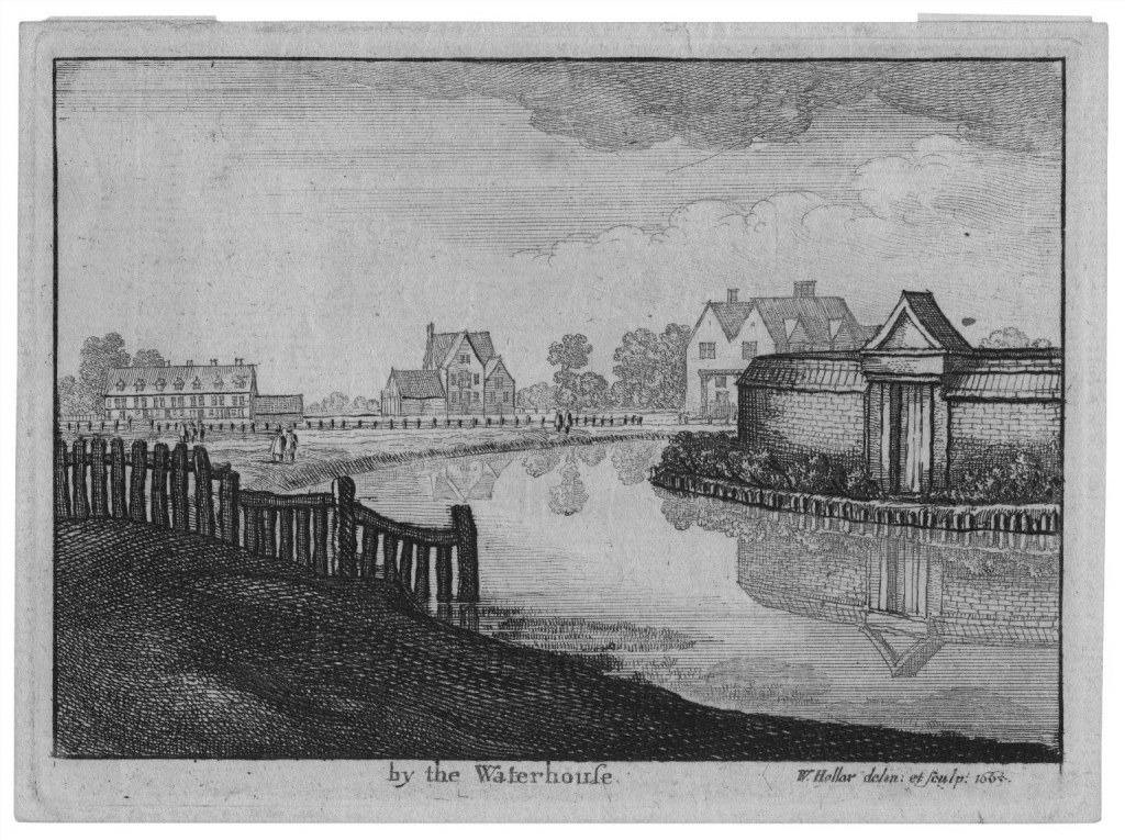
The New River originally finished near Clerkenwell, at what was to be named ‘New River Head’. Here, the New River Company had their head offices, known as the Water House, and there is still a beautiful grade-II listed building dating from the early 20th century at this site, although predictably it is now flats. The New River now finishes at the East Reservoir of the Woodberry Wetlands, built in 1833. The West Reservoir has been converted into a water sports centre.
An etching of New River Head by Wenceslaus Hollar (1665)
Time to explore! As the New River is so large (20 miles end-to-end!), I have chosen to explore a tiny section close to my home. I’d love to explore more of this waterway, so this may turn into a series in the future!
My route along the New River Path
I began my journey at Wood Green Mall, turning off down Alexandra Road adjacent to Boots, before taking an immediate right through Martins Walk, and then onwards down Mayes Road until I reached the pedestrian crossing. I then crossed the road and continued onwards down Coburg Road. I was a little unsure at this point if Google was leading me the right way, as it appeared to be an industrial estate, but before long I found myself opposite the entrance to a tunnel, with signs for the New River Path. Phew!
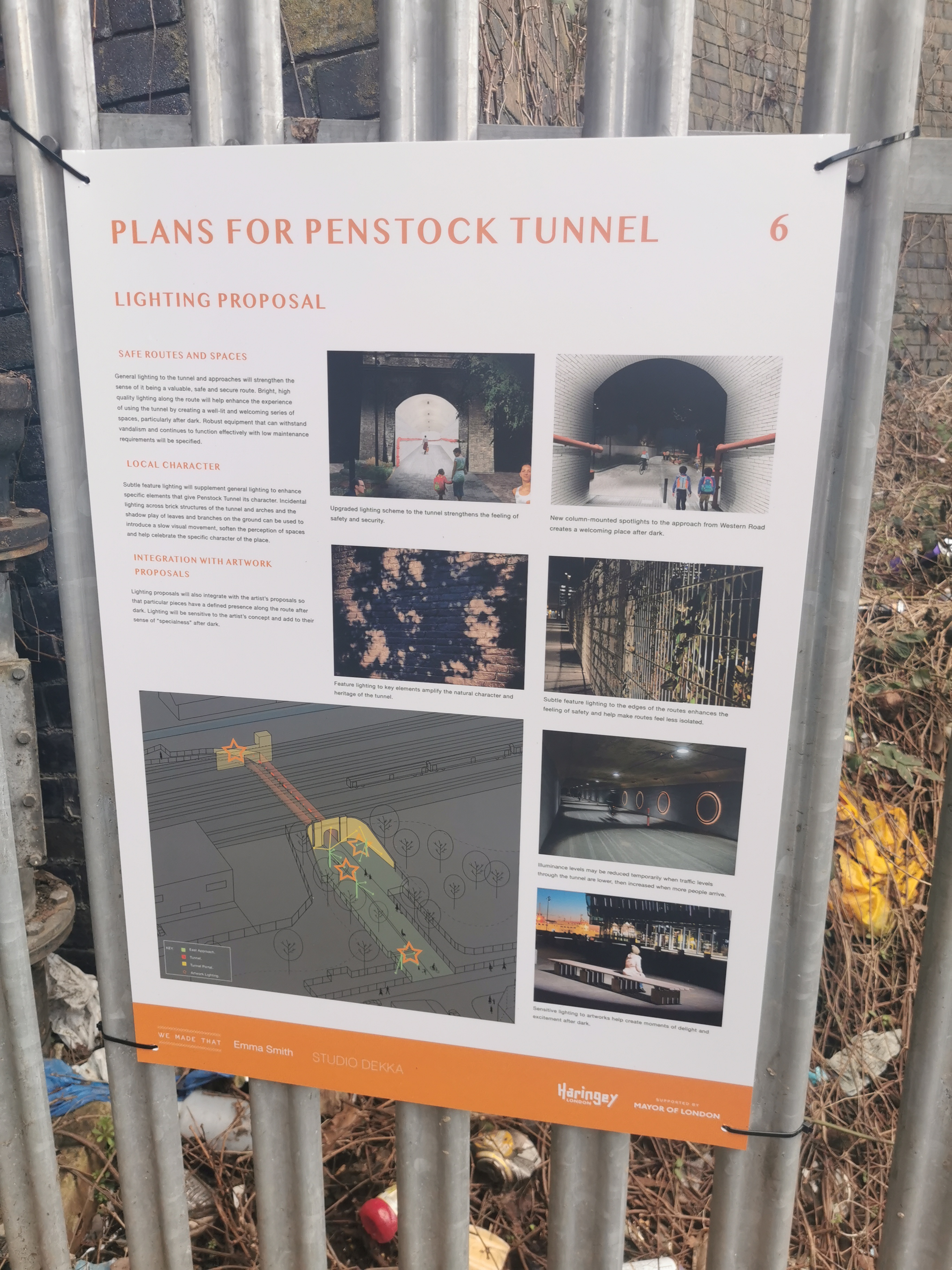
These signs also informed me that this tunnel was called Penstock Tunnel, and there was proposed plans to improve lighting and make it a more child-friendly place, which made me very happy to see! I love seeing councils make great use of space, especially when it has historic significance. Looking forward to seeing how this progresses.
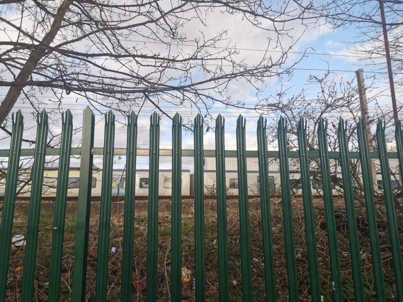
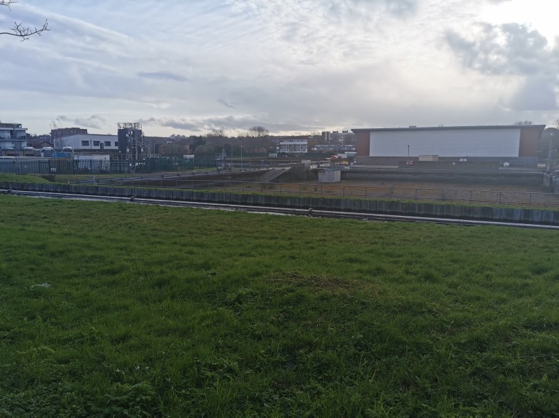
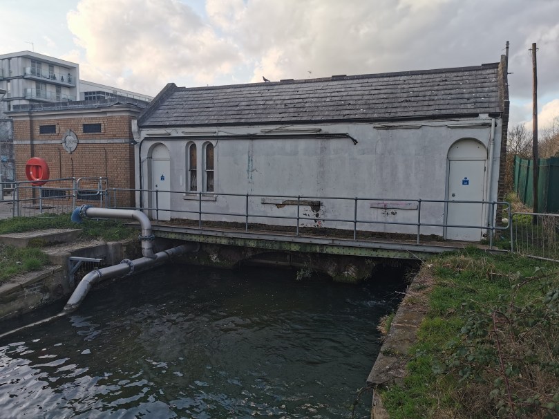
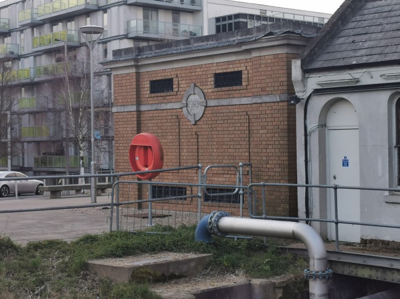
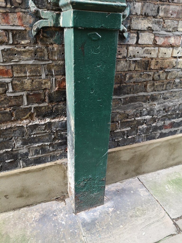
Penstock Tunnel runs under the London Loop railway, before joining the New River on the following side (although the other side of a fence), and running parallel to both – I even managed to get a snap of a passing train! This section of the New River also contains a water treatment plant – Thames Water Hornsey Water Treatment Works. A few minutes walk and the path comes to a gate, where the water treatment plant ends and the fence by the river is removed. This is also the point where turning right will take you across the river and into the northern end of Hornsey, with Alexandra Park immediately to your North – I believe this area is also known as Campsbourne? Feel free to correct me in the comments!
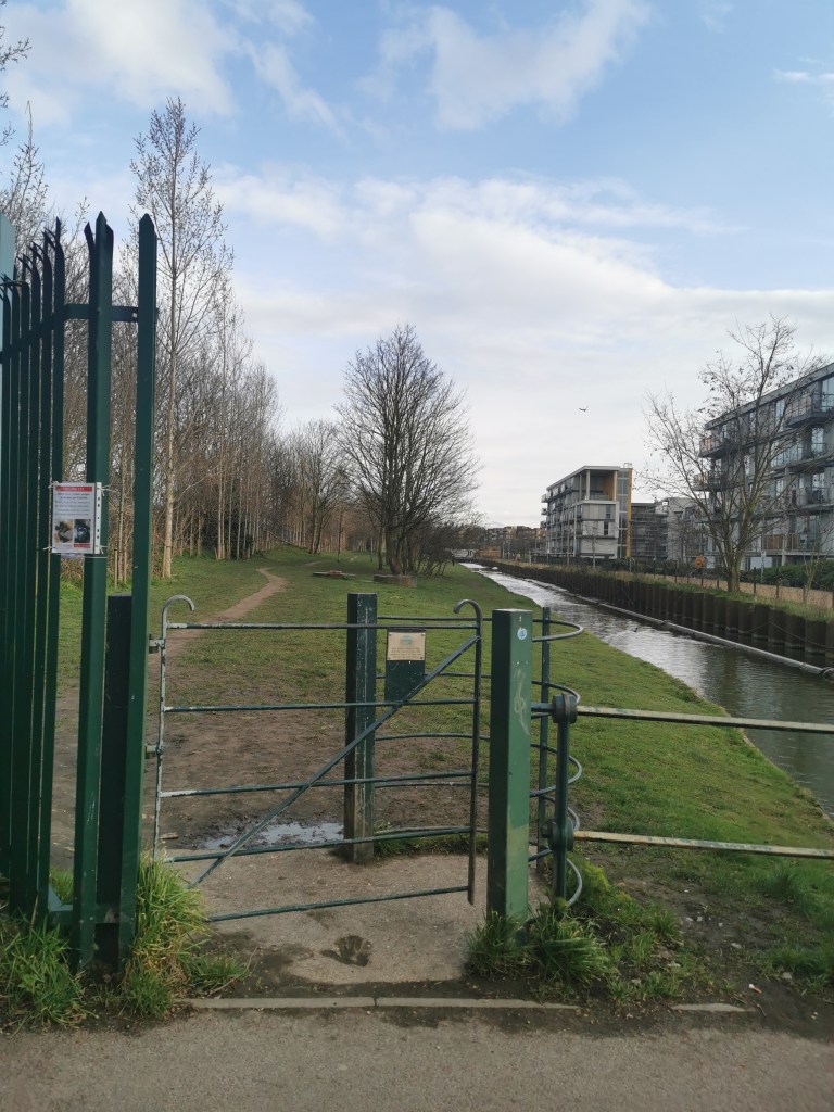
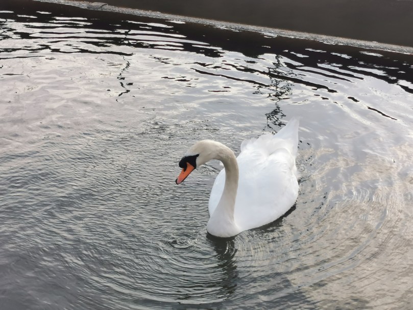
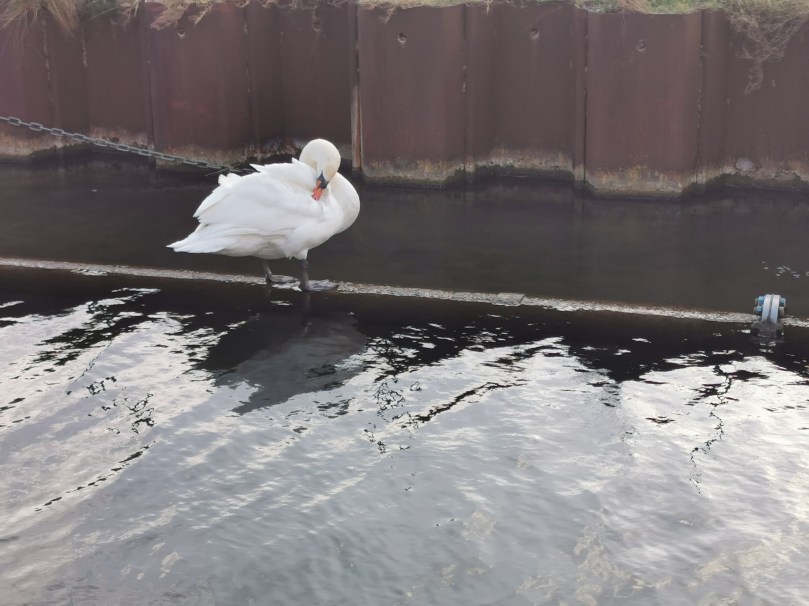
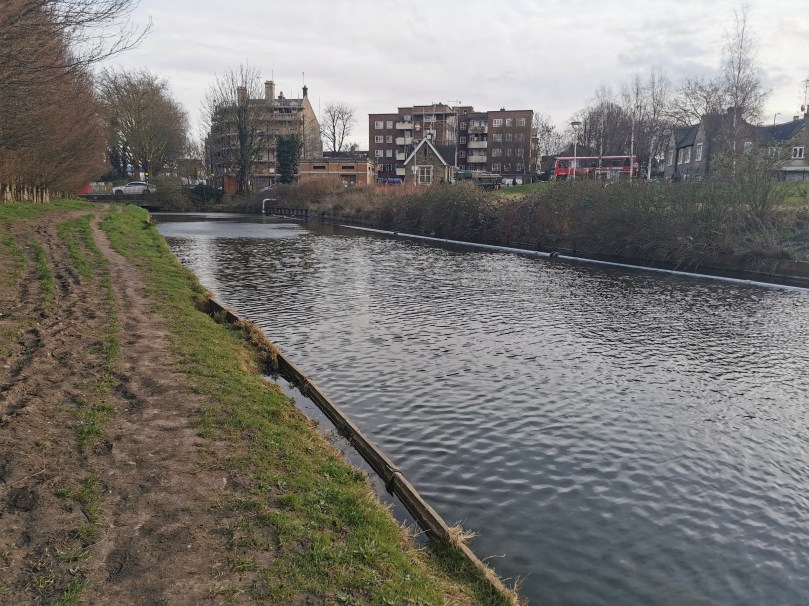
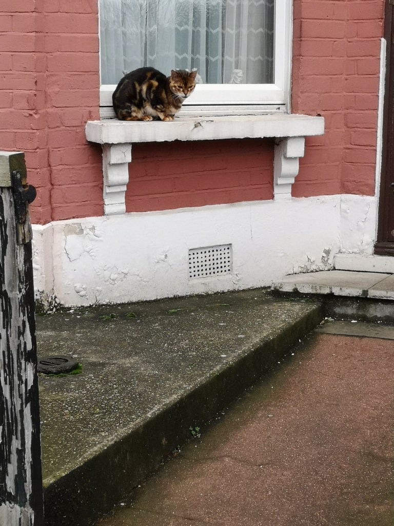
This next section is a pleasant walk alongside the New River, with some modern apartments on the opposite side. There were a few dog walkers along this route, and I also met some wildlife! It’s a very peaceful little walk, despite the regular rumble of passing trains – although maybe I’ve just lived in London long enough now that I don’t notice this anymore!
This grassy route continued right up until Turnpike Lane (the road, not the station) and included this little building, which I think might be a pump station of some kind? Let me know in the comments if you know what this is!
At this point the New River path ends, as it continues under Turnpike Lane and Hornsey Train Station. To rejoin it, I turned left out of the gate down to the big junction where Turnpike Lane meets Hornsey Park Road and Wightman Road. I then crossed to Wightman Road, and continued up to Hampden Road, as if going to Hornsey Station. Just before the station steps (the station is situated on a bridge, as many of the stations on this route are) there is a gate on the left hand side of Hampden Road, and the New River Path begins again. This is a section I am very familiar with, living on the Harringay Ladder, and it has been a frequent lockdown walk of mine! It also contains this instructing structure, which again, if anyone can tell me what this is, I’d love to know!
At the end of this section the path crosses to the opposite side of the river and onto Wightman Road, and the New River continues underground before reappearing through the Harringay Ladder itself. However, at this point, I follow Allison Road as far as the Harringay Passage and continue home.
And so concludes my post on the New River! Have you ever walked a section? Have you ever walked the entire length? What’s your favourite section? What are the structures I found on my exploration? Let me know in the comments!
I’m returning to my roots in this post. Being back in the North East of England has reminded me of the amazing rich folklore and history of this area, particularly the North York Moors and surrounding area, which was the backdrop to my childhood. It’s a strangely magical place; full of Mesolithic and Neolithic burial mounds, Roman roads, Viking and Ango-Saxon burial sites and early examples of British Christianity. In short, it’s very old, very isolated, and very exposed to the elements.
It’s not surprising that the moors and the coast to the east of it have inspired so many fascinating tales, not least Bram Stoker’s Dracula in my hometown of Whitby. Whitby alone has such a wealth of history and folklore, some of which I’d like to explore in more detail at a later date, but today, my attention turns to a tiny hamlet a few miles north of Whitby, called Kettleness.
Kettleness, which perches on the edge of an infamously unstable cliff of the same name (Ness is Old Norse for ‘headland’), consists of only a handful of houses and has the Cleveland Way passing right through it. A site of alum mining, it used to be considerably larger, but unfortunately in December 1829, the Ness experienced one of it’s landslides, and the whole village crumbled with the cliff into the sea! Now made up of a few local residents, a scout hut based in an old railway station (there also used to be a railway linking it to Whitby and Loftus. Another story, another day!) and some holiday cottages, most visitors are probably unaware of it’s link to Stoker’s famous novel…
Reverend Dr Donald Omand was a Devon clergyman and a high profile practioner of exorcism. Sometime in the 1950’s, he received a letter from a schoolmaster in Kettleness, telling a terrifying story;
‘On visiting Kettleness they [a schoolmaster and two friends] all experienced a wave of terror when, looking over the shore to the misty sea, they had seen a huge hound—so large it could not be mortal—appear out of thin air. Silent with shock they watched it move towards them before disappearing as silently and mysteriously as it had come. All three were left with such a strong sense of evil that the schoolmaster believed it was a case desperately in need of exorcism.‘
Extract from Dr Omand’s biography – ‘To Anger the Devil’ by Marc Alexander
Dr Omand wasn’t a stranger to Kettleness or it’s folklore. He had visited the village as a child, and later, whilst working as a reporter for the Northern Echo, interviewed a fisherman who claimed he had seen a huge black dog appear and disappear there more than once. He had also read Dracula as a teenager and was reportedly profoundly affected by it, and believed that Stoker himself had been to Kettleness and seen the dog for himself, inspiring parts of the novel. Unsurprisingly given this personal link, Dr Omand sent a telegram to the schoolmaster and arranged to meet him at Scarborough Station. They then travelled the 30 miles to Kettleness by car, arriving at nightfall…
‘”All we need now is for Dracula to come bounding ashore in the form of a great black dog,” muttered Donald with a smile. But the smile froze as his companion suddenly gripped him by the arm….
What we saw looked like a huge black hound, but bigger than any member of the canine species, known to man. It was moving straight in our direction and the schoolmaster’s nerve gave way completely. He rushed back to the car.
Uncorking the bottle [of Holy Water] which I was carrying, I commanded the spectre as follows: “Be gone in the name of the Lord Jesus Christ. Be gone to the place appointed for you, there to remain for ever. Be gone in the Name of Christ.”
As I spoke the last words, I splashed Holy Water in the direction of the apparition, and the latter disappeared as suddenly as it had materialised. Then I exorcised all the ground which the spectre had covered and a great heaviness went out of the atmosphere. The menace of Kettleness was ended.’
The story doesn’t end well for our poor schoolmaster. He apparently never recovered and had a breakdown, before being admitted to hospital suffering mental illness. Dr Omand however, continued with exorcism, his more notable cases being exorcisms of Loch Ness, and the Bermuda Triangle!
There are many theories as to the origins of the Black Dog, or ‘Barghest’ as it’s known in some parts of the North. The Black Dog features heavily in British folklore, and ‘sightings’ continue to this day in various spots in the country. And as mentioned, Kettleness is very much part of old Viking country, and may still have snippets of old Norse lore, like the wolf Fenrir.
But most interesting of all, is the fact that less than a mile from Kettleness, at Goldsborough, lies the site of an ancient Roman Signal Station, one of many along the North East coast. During excavations of this site in the early 20th century, a gruesome discovery was made.
The skeleton of a man, and at his throat, the skeleton of a large dog.
In 1621, William Rowley, Thomas Dekker and John Ford wrote a play titled ‘The Witch of Edmonton’. Described as “probably the most sophisticated treatment of domestic tragedy in the whole of Elizabethan-Jacobean drama”, the plot is familiar to those who know their witchcraft history – old woman is different, old woman is ostricised, old woman gets revenge, or is perceived to get her revenge.
But the Elizabeth Sawyer of the play was a real woman, convicted and executed for witchcraft in the same year the play was written. Who was she? What is the true story that inspired three men to write their play?
Our only source of information is her confession. Henry Goodcole was the chaplain at Newgate prison and heard confessions and wrote pamphlets about particular criminal cases. In Elizabeth’s case, he published her confession in a pamphlet entitled “The wonderfull discouerie of Elizabeth Savvyer a witch late of Edmonton” . These pamplets were a common occurance of the time. They filled society’s desire for lurid details and shocking stories, much like tabloids and trashy magazines today.
Little is known about Elizabeth Sawyer, other than what Henry describes to us in his pamphlet. We know that she lived in Edmonton. Interestingly she is described as a spinster in one part of Henry’s pamphlet, but in her confession she also briefly mentions a husband. She could perhaps be a widow, but no more of her marital status is mentioned. She doesn’t appear to have any children, or any family living nearby. And unlike her accusers, she does not appear to have a good social reputation.
Title page from a 1658 printed edition
Elizabeth was accused of murdering her neighbour Agnes Ratcliffe through the means of witchcraft. Henry explains that Elizabeth had laid out some soap, which Agnes’s sow licked up. Elizabeth, angry at this turn of events, told Agnes that “it should be a deare blow unto her”. That night Agnes fell ill. Her illness could not be explained by anyone in the village, and the presence of foaming at the mouth and “distemper” caused her neighbours to suspect witchcraft. Agnes also named Elizabeth Sawyer as the one who bewitched her. Within four days Agnes was dead.
This was not the first time Elizabeth’s name had been linked to witchcraft within her local community. A local Justice of the Peace, Mr Arthur Robinson, “…had often & diuers times, vpon the complaints of the neighbours against this Elizabeth Sawyer, laboriously and carefully examined her, and stil his suspition was strengthened against her, that doutlesse shee was a Witch.” Arthur Robinson had long suspected Elizabeth of being a witch, and upon this new accusation, immediately called for women to be brought to search her body for the mark of the witch. Elizabeth, understandably, was not best pleased at being strip-searched and “behaued her selfe most sluttishly and loathsomely towards them, intending thereby to preuent their search of her”. However, the women forced her to comply, and found what they were looking for. Elizabeth had “a thing like a Teate the bignesse of the little finger, and the length of halfe a finger, which was branched at the top like a teate, and seemed as though one had suckt it, and that the bottome thereof was blew, and the top of it was redde”. The discovery of such a thing may as well have been an outright admission of guilt. Elizabeth denied it’s very existence, which in the eyes of the Jury, showed her true character. It was at this point that Elizabeth was taken into custody, and met Henry Goodcole and gave her confession.
Henry begins by asking her how she came to meet the Devil, who was behind her despicable powers, and how she knew it was the Devil. Elizabeth explains she had been cursing and blaspheming, and at this moment the Devil appeared to her saying “Oh! haue I now found you cursing, swearing, and blaspheming? now you are mine.” She goes on to warn people not to engage in sin, as it was her choice of language that made the Devil single her out for his use. Henry asked what she said to the Devil, and was she afraid? Elizabeth explains she was very afraid, but the Devil reassured her that he was not there to harm her, and that he was actually there to help her, by carrying out ‘mischiefs’ at her bidding. She admits that she had been the cause of many Christian’s and beast’s deaths, and that her motivation had been malice and envy, and that if people had angered her, she called on the Devil to act out her revenge. Despite her earlier claims that the Devil had said that he intended her no harm, Elizabeth also explains that he desired her body and soul, and would tear her to pieces if she did not comply. The sealing of this agreement was in the form of sucking blood from her, and it was the repeated suckling that caused her teat to appear. She was also instructed not to tell anyone about their arrangement, also under the threat of being torn to pieces.
The Devil also mocked her for praying to Jesus, and instructed her to pray to him, giving her Latin words to do so. This is particularly interesting to me as these events are at the tail end of the reign of Elizabeth I, a period when Catholicism was seen by Protestant clergymen as “closely associated” with witchcraft, or at least just as offensive to good and proper Christianity. Elizabeth goes on to say that the Devil appeared to her as a dog called “Tom”, and that he appeared either black or white. She then wraps up her confession by explaining that she confessed to clear her conscience, and to better prepare herself for death (her execution). I tried to find Elizabeth’s records from her trial at the Old Bailey, but unfortunately her trial just pre-dates the earliest records the Old Bailey has.
Sadly, this is where Elizabeth Sawyer’s story ends. She was convicted under the Witchcraft Act in April 1621 and hanged at the Tyburn Tree for murdering her neighbour by diabolical means. The Tyburn Tree was a gallows in what was the village of Tyburn, now a bit of pavement of a corner of Hyde Park by Speaker’s Corner.
Marker at the site of the Tyburn TreeIllustration from around 1680 from the National Archives at Kew
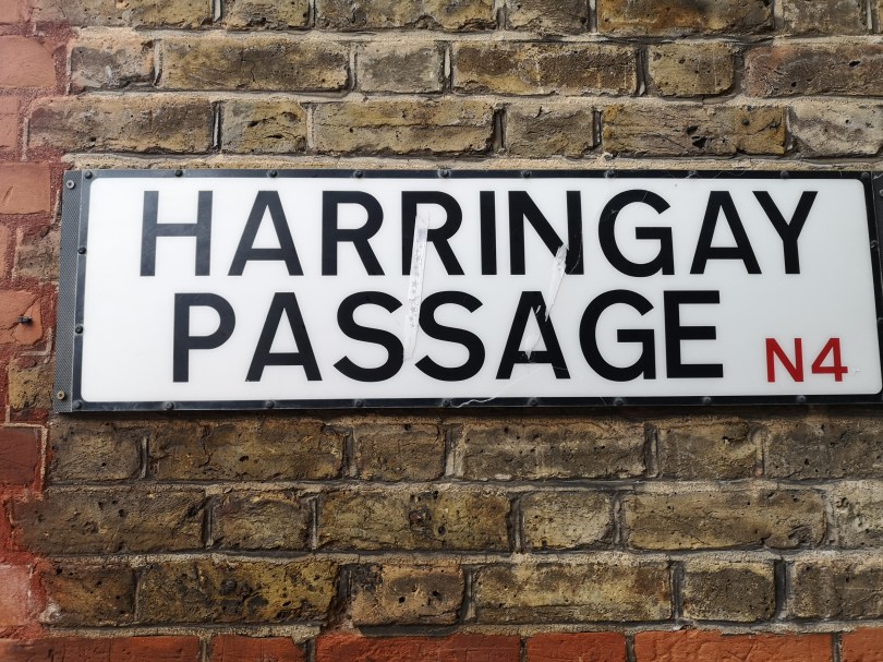
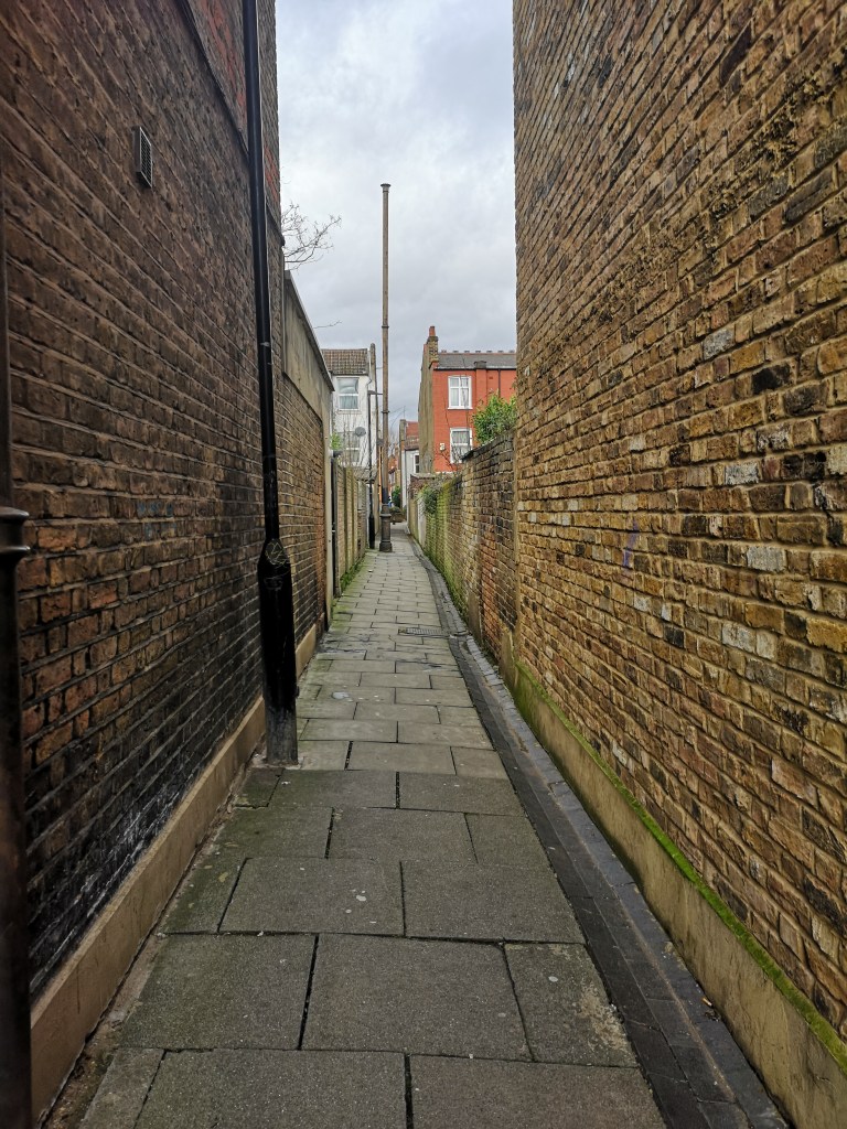
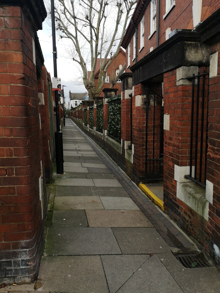
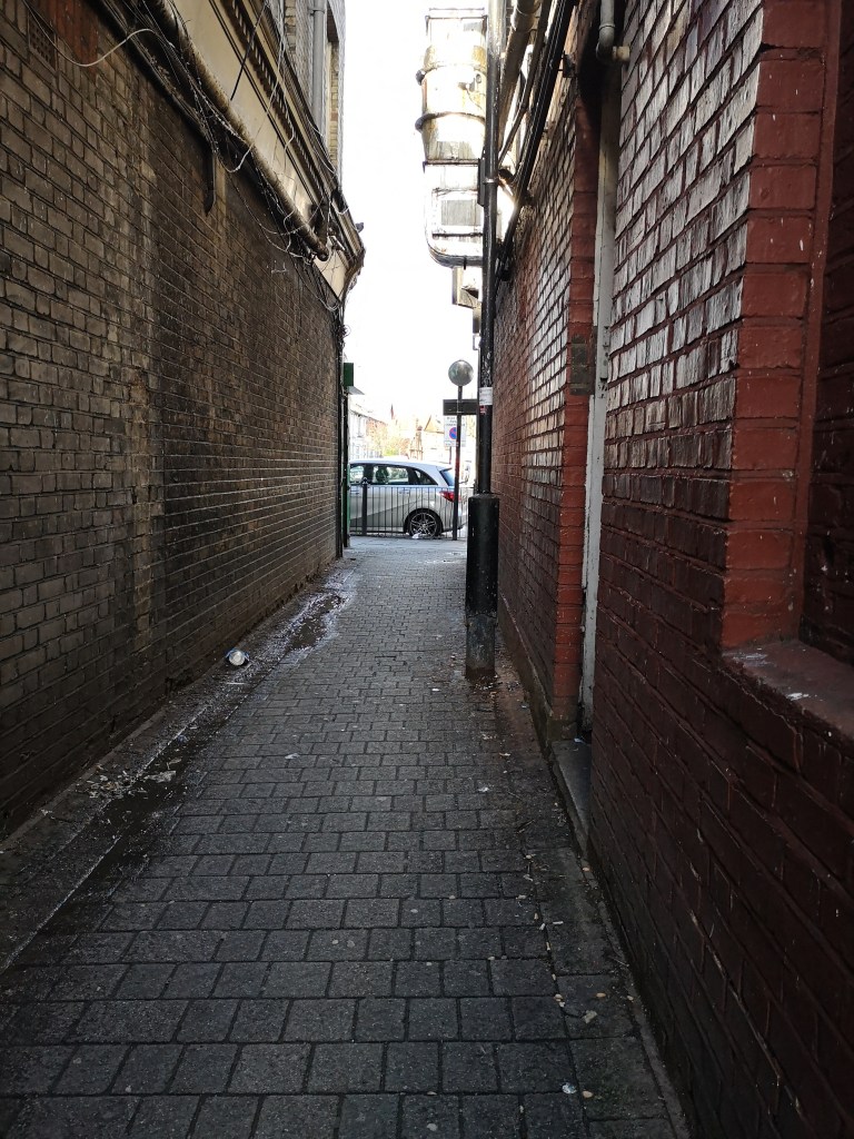
Snaking through the streets of the Harringay Ladder, a housing estate tucked alongside Green Lanes between Turnpike Lane and Manor House, is an unassuming little alleyway. It is used daily by the residents who probably don’t give it much thought, but the fact that this alleyway runs right through these houses and is named, got me curious. Most alleyways don’t have their own identity. What makes the Harringay Passage different?
To start with, Haringey or Harringay? The etymology of the words are all different variations of the same Old English: Hæringeshege. Hæring was a Saxon chief who lived probably in the area around Hornsey. Hæringeshege meant Hæring’s enclosure and evolved into Haringey, Harringay and Hornsey.
In modern use, the two spellings have distinct uses. Haringey, is a London borough, just north of Camden, and south of Enfield. It encompasses 11 square miles, including Alexandra Palace, Tottenham, Wood Green, Finsbury Park, Muswell Hill, Highgate, Seven Sisters, and Harringay the district itself, among others. Harringay the district runs from Duckett’s Common, a small park just south of Turnpike Lane station, to the top of Finsbury Park. It’s centre is Green Lanes, which the Harringay Ladder and Harringay Passage run alongside.
Up until 1880, what is now the Ladder, was Harringay House, and it’s extensive grounds, Harringay Park. Harringay House was the largest house in the area at the time, built in 1792 on the site of an old Tudor House pulled down in 1750. As London’s population grew from around 700,000 in the mid 18th century, to 5.5 million at the close of the 19th century, there was an obvious need for expansion outwards. Harringay, among many other areas outside London, was enveloped into a suburb.
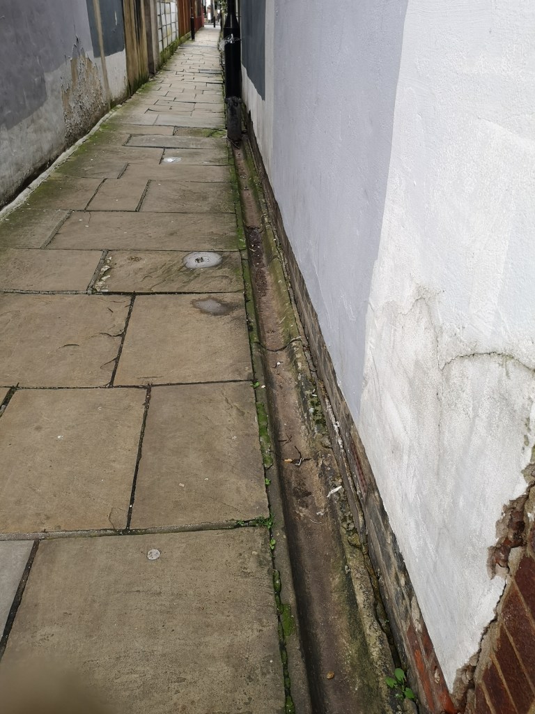
Interestingly, what became the Harringay Passage pre-dated the Ladder. Up until the mid 19th century, the borough of Hornsey paid the borough of Tottenham to dispose of it’s sewage in the river Lea. Then in 1869, Hornsey commisioned Baldwin Latham, a consulting engineer, to improve the area’s sewage. The result was Hornsey Outfall Sewer, which can be seen above as a faint blue line running through Harringay Park.
The Harringay Ladder (named so because on a map the streets look like the rungs of a ladder) was built between 1880 and 1900 as two seperate housing estates, Hornsey Station estate at the north end, and Harringay Park estate at the south. As the streets developed, nothing could be built above the sewer, and so it became a footpath. Thus the Harringay Passage was born!
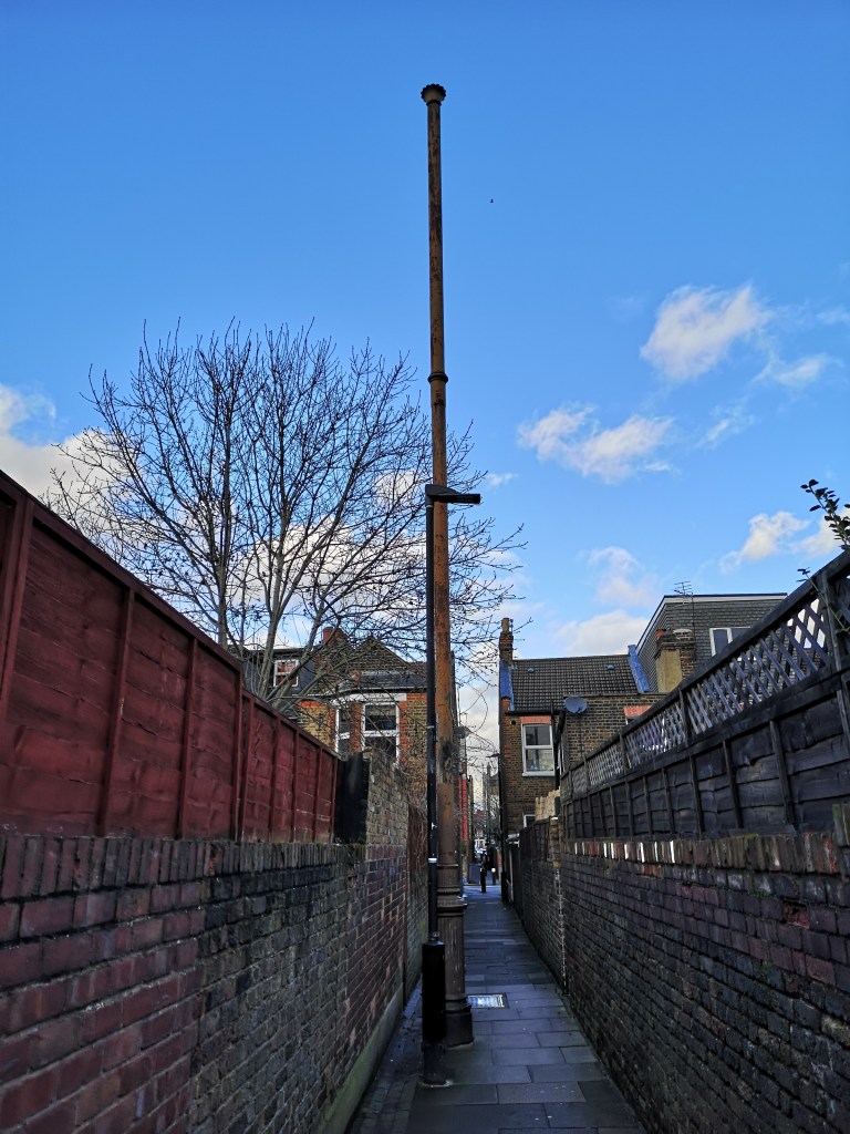
Time to explore! I began my route from the south end of the passageway, on Umfreville Road. The pathway may once have led to Harringay Railway Fields but is now blocked off.
The Harringay Passage is particularly valuable as a safe walking route between the schools at either end; North Harringay Primary, South Harringay Infants and South Harringay Juniors. These schools were all built along with the ladder, and are classic Victorian red brick schools.
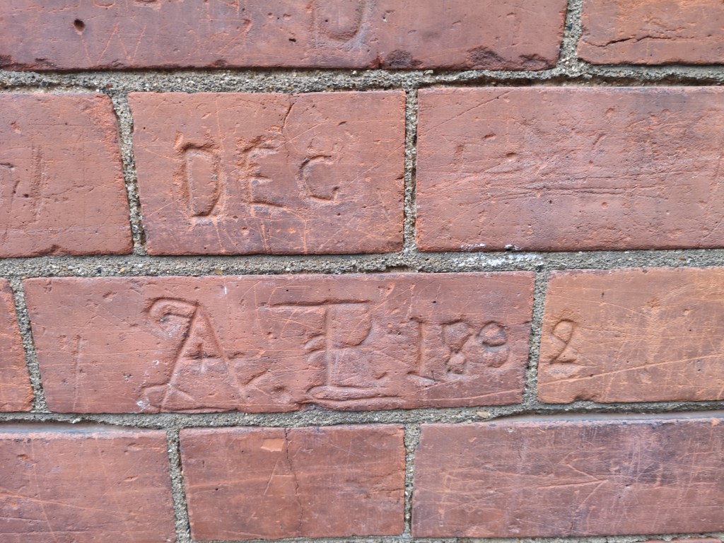
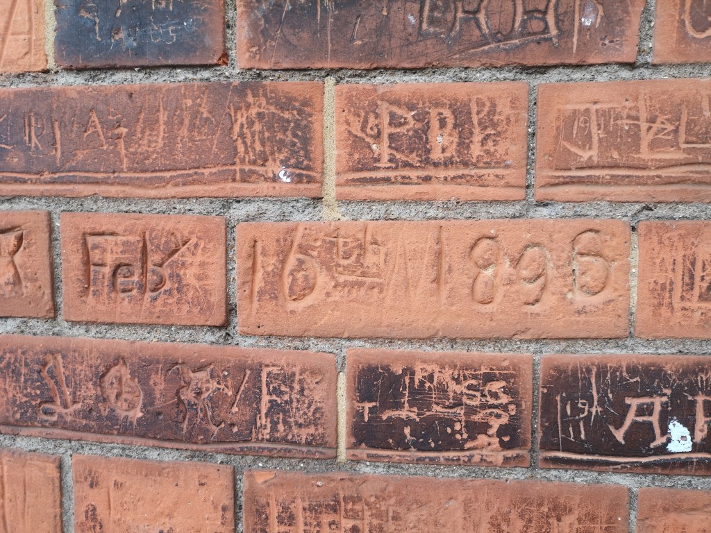
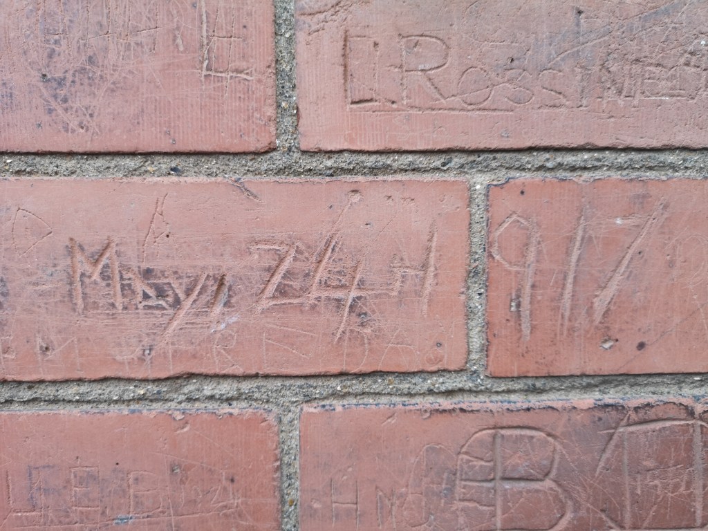
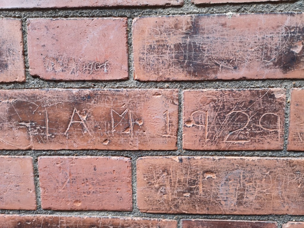
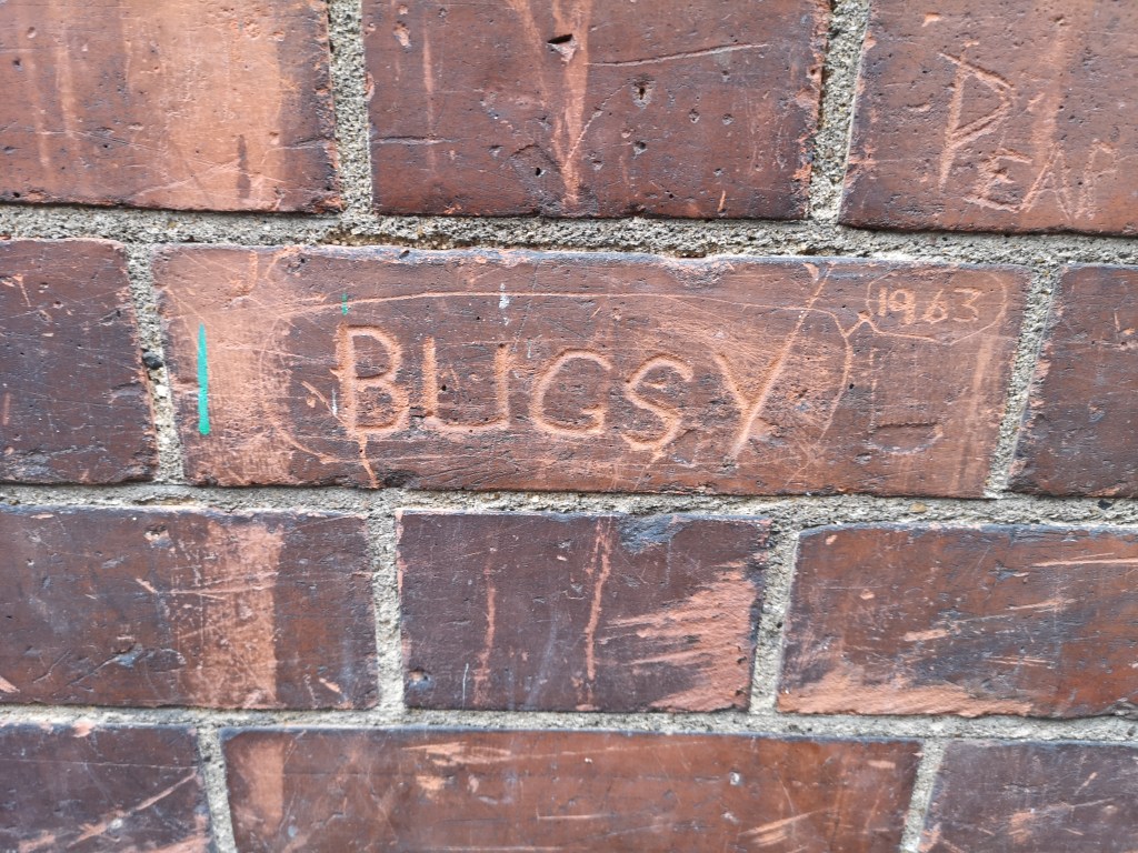
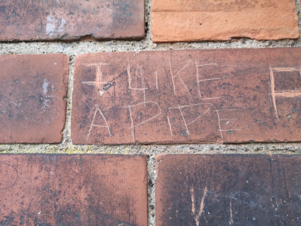
Of particular interest is a section of wall in the Passage running adjacent to North Harringay Primary, connecting Falkland Road and Frobisher Road. I walked past this wall countless times before one day noticing it’s graffiti, which spans a period of over 120 years!
This section of wall is possibly my favourite part of the Harringay Passage, as it’s exactly the kind of history I set this blog up to document. Little examples of history left by ordinary people, in this case, mostly school children.